


Desk Report
Publish: 11 Jul 2020, 10:48 am
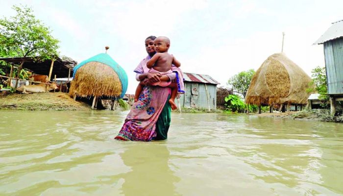
The Teesta crossed the danger mark at the Dalia point in the Nilphamari district on Friday evening, as the main rivers started to rise again following the influx of massive water from the upper catchment area of the Brahmaputra basin in the last 24 hours.
"With a sudden increase in water levels, Teesta was now at 6 p.m. 28 cm over the danger mark at Dalia point in the Nilphamari district," said Executive Engineer of Teesta Barrage Division of the Bangladesh Water Development Board (BWDB) Md. Rabiul Islam has told the media.
Any of the low-lying and char areas of the four Upazilas in Nilphamari and other places adjacent to the Lalmonirhat districts were again flooded as the Teesta River reached its danger mark on Friday evening.
The BWDB official said water levels of all major rivers marked rises following onrush of huge water amid heavy monsoon rains from the upper catchment in India in the basin during the last 24 hours till at 9 am on Friday. The rising trend in water levels of major rivers might continue during the next 72 hours and the Dharla may also cross the danger mark in the next 24 hours.
According to the BWDB Flood Forecasting and Alert Center (FFWC), heavy rains increasing persist in northern Bangladesh and the neighboring northeastern Indian states of Assam , Meghalaya, Bihar and West Bengal for the next 72 hours.
During the past 24 hours till 9am, 551mm rainfall was recorded at Cherrapunji, 120mm at Shillong, 297mm at Pasighat, 99mm at Dhubri, 154mm at Goalpara and 50mm at Jalpaiguri points of the northwestern Indian states in the upstream. Besides, 103mm rainfall was recorded at Chilmari in Kurigram, 58mm at Kawnia in Rangpur and 53mm at Gaibandha monitoring points of BWDB during the same period.
Due to the huge upstream onrush, the water levels of the Dharla rose by 18 cm at Kurigram, Brahmaputra rose by 15 cm at Noonkhawa and 10 cm at Chilmari during the last 24 hours to 9 am on Friday.
In addition , the water levels of the Jamuna River grew by 11 cm at Fulchhari, 6 cm at Bahadurabad, 4 cm at Sariakandi, 2 cm at Kazipur and 4 cm at Sirajganj during the time.
The Dharla was flowing just 24 cm below the danger mark at Kurigram, Brahmanpara 43 cm at Noonkhawa and 31 cm at Chilmari and Ghaghot 50 cm below the danger mark at Gaibandha at 9 a.m.
During the same period, the Jamuna was flowing only 11cm below the danger mark at Fulchhari in Gaibandha, 21cm at Bahadurabad in Jamalpur, 27cm at Sariakandi in Bogura, 35cm at Kazipur and 39cm at Sirajganj points.
While talking to the media, Chief Engineer for the Rangpur Zone of BWDB Jyoti Prosad Ghosh said that the water levels of the rivers Dharla, Teesta, Brahmaputra and Jamuna could continue to rise further in the next 72 hours , causing a flood in the basin again.
"We are closely tracking the situation around the clock and ready to take urgent steps to restore any harm or disruption to flood control systems on an emergency basis everywhere in all eight districts of the Rangpur Division," he said.
"All flood control embankments and structures are remaining safe in the BWDB's Rangpur zone where riverbank protection works are continuing at most of the 52 vulnerable points in Lalmonirhat, Kurigram and Gaibandha districts," Ghosh added.
Source: BSS
Subscribe Shampratik Deshkal Youtube Channel
© 2024 Shampratik Deshkal All Rights Reserved. Design & Developed By Root Soft Bangladesh