


Desk Report
Publish: 28 Sep 2020, 01:46 pm
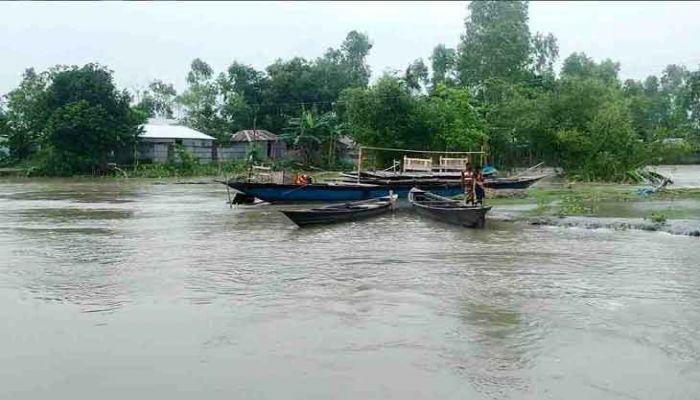
Heavy rains and upstream water are worsening the flood situation in Kurigram, flooding cropland, houses and cutting off road connectivity affecting thousands of people.
Shamsuddin Mia, acting director of the Department of Agricultural Extension (DAE), said that 17,135 hectares of cropland containing Ropa Aman, peanuts and vegetables, among others, had been under water in the district, reports UNB.
Hundreds of hectares of vegetable fields in Mughalbasa, Holokhana, Kanthalbari, Rajarhat, Chinai, Mirerbari, Mahidhar, Debalaya and Naodanga, and Shimulbari unions of Kurigram Sadar Fulbari submerged in heavy rains.
Meanwhile, the residents of the district's charcoal regions are in dire straits due to a food crisis in the middle of the flood as the grasslands are under water. Today, cattle owners are in trouble because the price of hay has doubled.
The flood also disrupted the travel and transport of goods on underwater highways, making it difficult to enter some areas.
In addition, erosion is occurring in various areas near the rivers Dharla, Teesta and Dudhkumar.
Erosion persists at 67 sites in the district.
Dharla was flowing 35 cm above the danger level at Kurigram Bridge Point on Monday morning. However, other rivers, including Brahmaputra, Teesta and Dudhkumar, flow below the danger point.
Ariful Islam, Executive Engineer of the Kurigram Water Development Board, said that water levels in other rivers, including Dharla, will rise further in a few days.
“There’s no fear of major floods,” he added.
Subscribe Shampratik Deshkal Youtube Channel
© 2024 Shampratik Deshkal All Rights Reserved. Design & Developed By Root Soft Bangladesh